


Qalqilya (Qalqiliya), Palestine: History, the Guava Orchards and Its Citrus Plain
TL;DR
Qalqilya, also written Qalqiliya, is a Palestinian city in the north-western West Bank, about 14 kilometres south of Tulkarm and about 27 kilometres west of Nablus. Roman sources call it Calecailes and Frankish ones Calcelie. An Ottoman tax register of 1596 lists it as Qalqili in the nahiya of Bani Sa'b, in the liwa of Nablus, paying 3,910 akce on wheat, barley, summer crops, olives and goats or beehives. It had a municipal council by 1909 and an Ottoman saraya by 1913. In 1945 it counted 5,850 people and 27,915 dunums of land, of which 3,701 were planted with citrus and bananas. The 1949 armistice line cut those groves away from the town. In 1967 a United Nations representative recorded 850 of the town's 2,000 houses demolished. The city replanted on what was left, and it is now the centre of guava growing in Palestine, with roughly 70,000 trees and a harvest of more than 8,500 tons a year.

What Does the Name Qalqilya Mean?
The name is older than any of the empires that wrote it down. Roman-period sources give it as Calecailes. Frankish medieval sources give it as Calcelie. Edward Henry Palmer, working through Arabic place names in the nineteenth century, derived it either from a variety of pomegranate or from the gurgling of water. A Canaanite reading takes it to mean rounded stones or hills, which suits a town sitting exactly where the coastal plain runs up against the low hills to its east.
The Palestinian national information centre records another reading worth keeping: the Aramaic root qailula, the rest taken in the middle of the day. Qalqilya sat on the old road between Damascus and Egypt, and a caravan stopping at midday stopped where there was water and shade. On that reading the name is not a description of the ground at all. It is a description of what the place was for.
A Waystation on the Plain
Flint tools found in the area put people in the vicinity in prehistory. After that the town appears in the record the way small places on busy roads usually do, as a line in somebody else's administration. In the Roman period it fell under the district of Antipatris. Under early Islamic rule it followed Lydda. Under the Fatimids it was attached to the district of Kafr Saba, and under the Mamluks to Jiljulia.
None of those authorities built the town a monument. What they left instead is the road. Qalqilya's position, on the flat ground between the sea and the hills, on the route that carried traffic from Damascus down towards Egypt, is the single fact that explains almost everything else about it: why it was farmed so intensively, why it grew into a market rather than a fortress, and why in the twentieth century a line drawn on a map could take away its livelihood without touching a single house.
The Village in the Nahiya of Bani Sa'b
The Ottoman tax register of 1596 lists Qalqili in the nahiya of Bani Sa'b, part of the liwa of Nablus. The village paid 3,910 akce in tax on wheat, barley, summer crops, olives, and goats or beehives. That list is a farming inventory. Four centuries before the citrus and the guava, the ground was already being worked hard.
Edward Robinson passed through in 1838 and recorded the village as Kulakilieh, in the Beni Sa'ab district west of Nablus. The Survey of Western Palestine described it in 1882 as a large somewhat straggling village, with cisterns to the north and a pool on the south-west. In 1883 families from Baqat al-Hatab moved down and settled there. A municipal council was established in 1909, and in 1913 an Ottoman saraya was built as the administrative seat of the nahiya. The building still stands, and it is now a school.

27,915 Dunums: What Qalqilya Farmed Under the Mandate
The British Mandate censuses give the town its shape. In 1922 Qalqilya counted 2,803 people, of whom 2,794 were Muslims and nine were Christians. By 1931 it held 3,867 people in 796 houses. By 1945 the population had reached 5,850.
The land figures from 1945 are the ones that matter. The town held 27,915 dunums. Of those, 3,701 were planted with citrus and bananas, 3,232 were plantations and irrigable land, 16,197 were sown with cereals, and 273 were built up. Read that back slowly. The houses occupied less than one per cent of what the town owned. Everything else was orchard, irrigated garden or grain.
Qalqilya was among the most prosperous towns in Palestine at that point, holding extensive orange groves and serving as one of the main vegetable markets in the country. The oranges were part of the same coastal citrus economy that made the name of Jaffa, the port city that shipped the crop to Europe, and that turned the Jaffa orange into a symbol of Palestinian land and labour.
What Happened to Qalqilya's Orange Groves in 1949?
In 1948 the residents of Qalqilya fled and then returned, alongside Jordanian Arab Legion and Iraqi forces, with the exception of around 2,000 better-off residents who settled in Nablus for economic reasons. The town then filled with people who had lost everything: families from Kafr Saba, Abu Kishk, Miska, Biyar 'Adas and Shaykh Muwannis resettled there, in a town whose own resources were about to be cut in half.
The armistice signed at Rhodes in 1949 drew the line immediately west of the town. It severed the orange groves in their entirety, leaving Qalqilya landless apart from the rocky ground to its east. The trees were still there. The people who had planted, pruned, irrigated and picked them were on the other side of a line, within sight of their own fields.
The same year did the same thing to Tulkarm, about fourteen kilometres to the north, and to Lydda on the plain to the south. The pattern along the whole coastal edge of the West Bank is one pattern: the towns kept their houses and lost their fields.
1967 and the 850 Houses
After the war of June 1967, dozens of residents were expelled to Jordan. A United Nations representative recorded that 850 of the town's 2,000 houses had been demolished. Moshe Dayan later characterised the demolitions as collective punishment and contrary to policy. Residents were eventually allowed to return, and the reconstruction of damaged houses was financed by the military authorities.
What that record describes is a town rebuilt on top of itself within a decade, twice dispossessed of its farmland and still standing on the same ground. The people who came back were the same people who had planted the groves their grandparents had planted.
The Guava Season, Mid-August to Late October
What Qalqilya did next is the part of its history that rarely gets told, because it is not a story about loss. Denied the citrus plain, the town replanted the ground it still held, and it turned out that the combination it had was almost unrepeatable in Palestine: sweet soil, sweet groundwater underneath it, and a mild, nearly subtropical climate on the low plain.
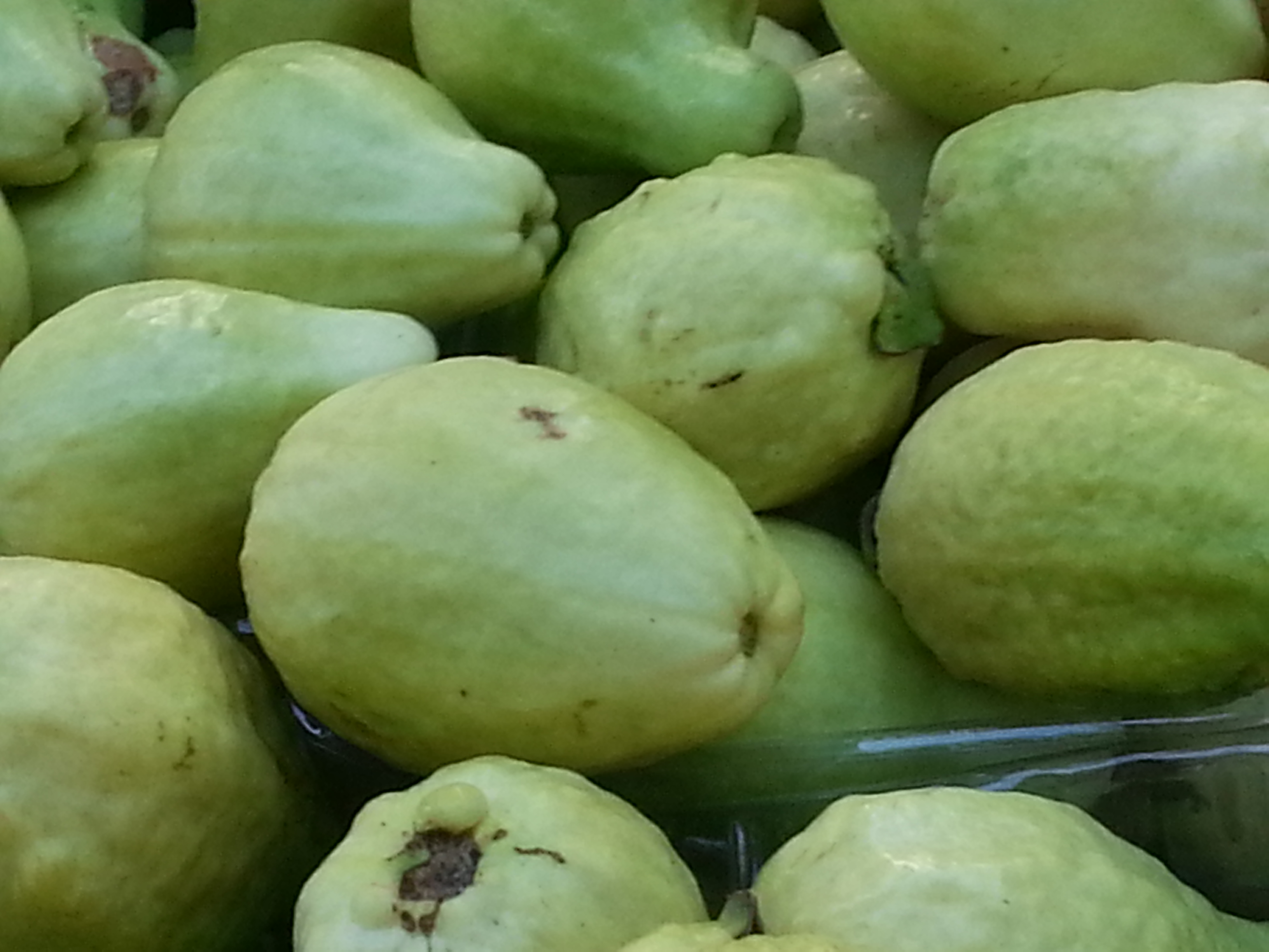
That combination grows guava. By the 2010s Qalqilya held roughly 70,000 guava trees, and the harvest ran to more than 8,500 tons a year. Around 800 families, some 2,400 people, drew an income from the fruit. The season is short, running from the middle of August to the end of October, which is why the whole city turns to it at once. Ibrahim Nizzal, director of the Qalqilya Chamber of Commerce, Industry and Agriculture, described the trade to Al Jazeera in September 2013: exports going to Jordan at 20 tons a day, 820 tons in the previous season, at an opening price of two and a half to three and a half dollars a kilogram.
Citrus never left either. Of the city's land today, 1,802 dunums are planted with citrus trees, which is over 30 per cent of its arable ground. Olives and vegetables make up most of the rest.
Lesser-Known Facts About Qalqilya
- The saraya built in 1913 to house the Ottoman district administration is still in use as a school.
- Qalqilya Zoo, established in 1986, is the only zoo in the West Bank and in Palestine.
- The Survey of Western Palestine noted in 1882 that the village had cisterns to its north and a pool to its south-west, a century before anyone described it as a city.
- Families from Baqat al-Hatab, in the hills to the east, resettled in Qalqilya in 1883.
- The 1596 Ottoman register taxed the village on beehives as well as on grain, olives and goats.
What the Wall Enclosed
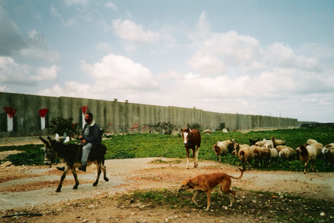
Construction of the separation barrier around Qalqilya began in 2002. In its March 2004 update, the United Nations Office for the Coordination of Humanitarian Affairs described the route as running south from Falamya, encircling Qalqiliya, and continuing to Masha in Salfit governorate. On the western side of the city the barrier takes the form of concrete slab segments eight to nine metres high, running for more than three kilometres along the Green Line. Gates were installed, with access restricted to Palestinians holding permits, and a tunnel was built to connect the city to Habla and the villages to its south.
The barrier isolates Qalqilya from the north, the west, the south and half of its eastern side, leaving one corridor open to the east. It occupies 283 dunums of ground itself, and it separated a further 1,836 dunums of mostly agricultural land and open space inside the city's jurisdiction from the city that owns it.
Set that against the 1945 land register and the arithmetic is plain. A town that held 27,915 dunums, of which 3,701 were citrus, lost the citrus plain in 1949 and then lost access to a large share of what remained after 2002. The guava harvest happens inside what is left.
The Orchard as a Record
Palestinian heritage is usually read off the things people made by hand: the stitched grammar of tatreez, the pottery, the woven cloth. Qalqilya keeps its record somewhere else. It keeps it in what grows.
An orchard is a long argument with time. Citrus takes years to bear. Guava takes years to bear. A family that plants trees on a plot is making a statement about how long it intends to be there, and about who it expects to pick the fruit. The same logic runs through the olive tree and what it carries in Palestinian life. Qalqilya lost its groves in 1949, was told in 1967 that its houses were negotiable, and planted 70,000 guava trees anyway.
That is why the orange, the olive and the fruit of the land appear on our pieces at all. They are not decoration. They are the same claim the orchards make, carried on cloth instead of soil. Our Palestinian orange collection and the wider Symbols of Palestine collection exist to keep that record legible outside Palestine, alongside the rest of our Palestinian heritage clothing.

Frequently Asked Questions
Where is Qalqilya in Palestine?
Qalqilya sits in the north-western West Bank, on the flat ground where the coastal plain meets the low hills, about 14 kilometres south of Tulkarm and about 27 kilometres west of Nablus. It lies directly against the 1949 armistice line, known as the Green Line.
What does the name Qalqilya mean?
There is no single settled answer. Roman sources call it Calecailes and medieval Frankish sources Calcelie. Edward Henry Palmer derived the Arabic name either from a kind of pomegranate or from the gurgling of water. A Canaanite reading gives rounded stones or hills, and an Aramaic reading connects it to qailula, the midday rest taken by caravans on the Damascus to Egypt road.
What is Qalqilya known for?
Farming. Before 1948 it was one of the main vegetable markets in Palestine and held extensive orange groves. Today it is the centre of guava growing in Palestine, with roughly 70,000 trees and a harvest of more than 8,500 tons a year, and it still holds 1,802 dunums of citrus. Qalqilya Zoo, opened in 1986, is the only zoo in Palestine.
How much land did Qalqilya lose in 1949?
The 1945 land register recorded 27,915 dunums held by the town, including 3,701 dunums of citrus and bananas and 3,232 dunums of plantations and irrigable land. The armistice line agreed at Rhodes in 1949 severed the orange groves entirely, leaving the town with the rocky ground to its east.
Why is Qalqilya surrounded by a wall?
Construction of the separation barrier around the city began in 2002. According to the March 2004 OCHA update, the route runs south from Falamya, encircles the city and continues to Masha, with concrete segments eight to nine metres high running more than three kilometres along the Green Line on the western side. The barrier leaves one corridor open to the east and separated 1,836 dunums of mostly agricultural land from the city.
A Town That Lost Its Fields Twice and Kept Planting
Qalqilya is not a ruin and it is not a monument. It is a working farming town that has been separated from its own land twice in one lifetime and has, both times, put trees back in the ground it still had. The 1945 register is a document about oranges. The 2013 harvest figures are a document about guava. Between them sits everything that was taken, and the fact that the planting did not stop.
Wear Heritage. Preserve History.
100% of profits from FALASTIN are donated to the United Palestinian Appeal.